Canaria info forside billede tekst

Hiking Route 6.  Valsequillo - Las Vegas

hiking6 1Starting point:
Valsequillo Altitude: 550 m Destination:
Las Vegas Altitude: 612 m
Total Distance: 1890 m
Time to cover the Route: 50minutes
Direction of the Route: NE-SW
Maximum Difference in Altitude: 141 m
Difficulty rating: Low

tur6 2

logo turisticoThis is a route that formerly connected two traditional agricultural valleys, crossed by the San Miguel and Los Mocanes ravines. The surface is made up of material from the collapse of the Tenteniguada erosive caldera. The route runs for a distance of 1865 metres in a NE-SW direction and can be covered in about 50 minutes.

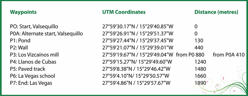
We shall start the route along a short, 130 m stretch of tarmac opposite Calvario, PO Start Valsequillo. We continue down the road to the E until we come to the beginning of a footpath after crossing the town of Chinchemy, where we will see crops of the famous Valsequillo strawberries.

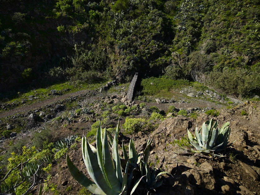
The footpath starts to the right of a large pond at point: P1 Pond. The route leads down the side of the San Miguel ravine, where we shall pass a closed-up cave. There is an abundance of rock-dwelling species that are endemic to the Canary Islands, such as lavender (Lavandula canariensis), Canary sage (Salvia canariensis), mato de risco (Allagopappus dichotomus) or bejeque (Aeonium percarneum), accompanied by other species such as broom or verodes.
The footpath winds downhill for about 310 metres to the bed of the San Miguel ravine. Here, we shall find a wall built to retain the water that flows down the course with a view to facilitating infiltration to improve the water table, point: P2 Wall.
At this point, there is an interesting alternative that will take us to an archaeological site of great interest. Heading east through crops and pastures, we shall come to a gentle slope that will take us to El Roque. This is a rocky fortress at a distance of 900 m from P2, where there is a pre-Hispanic troglodyte settlement (Image F3). There are many caves on the north face of the ravine; in fact, the neighbourhood of Los Llanetes originated through the use of the native caves as homes or shelters.
Back on the main route towards Las Vegas, or directly if you did not take the optional section, we shall continue making our way up the channel. The vegetation now reflects the greater ambient humidity and several species alternate, such as white tajinaste (Echium decaisnei), blue tajintaste (Echium callithyrsum) endemic to Gran Canaria, venenilla (Bryonia verrucosa), May blossom (Pericallis webbii), verodes (Kleinia nerifolia), tabaiba (Euphorbia regis-jubae) endemic to the Canary Islands, dock (Rumex Lunaria).
If we move on about 440 metres, we shall find the point: P3 Vizcaínos Mill on the right, which is located in the bed of the ravine, and shows how productive uses have changed, as it is no longer used for grinding the grain and remains as a testimony of former cereal use.

Due to these changes, many of the old rural roads disappeared or were almost obliterated, and the footpath we shall now take to make our way up the left-hand bank has been recovered for hiking after losing its original use. We shall climb 360 metres to point: P4 Llanos de Cuba, where we shall see crops and the Los Llanos de Cuba well at the end of the footpath.
Here, we can enjoy a landscape of buildings of ethnographic value, embedded between crops. It is not very difficult to find extremely important vertebrate species endemic to the island, such as the Canary Island lizard or the Gran Canaria skink, which has two subspecies, as well as some birds, such as the Canary Island chiff-chaff (Phylloscopus collybita canariensis), exclusive of the islands or the Canary Island blue tit (Parus caeruleus teneriffae), a subspecies endemic to Gran Canaria of the four that exist in the Canary Islands.

After about 240 m along a footpath marked by a stone wall, next to some crops, we shall reach point: P5 paved track.
The crops gradually give way to houses and after walking 180 m we shall reach point: P6 Las Vegas school, where we shall turn right to make our way up a rather steep hill and, after 230 m, reach the end of the route at point: P7 End Las Vegas, at the foot of the main road between Telde and San Mateo, GC-41. We are in a neighbourhood where quality local cuisine will help us regain strength and where artisans offer products based on the best of our traditions.

Alternative initial section
Instead leave from Chinchemy, we can do so from La Silla Street and walk down to the cross-roads at point P3 opposite the Los Vizcainos Mill.
This option has the added attraction of enjoying the views of the upper section of San Miguel ravine and of the many cave houses that dot this part of the slope. It also enables us to enjoy a closer view of the mill.
On this route, the distance to point 3 is considerably shorter, about 410 m compared with 880 m, so the total distance is reduced to 1420 m against 1890 m for the full route. We can also use it as the final part of the route back to Valsequillo from Las Vegas. In this case, the round route would be 3060 m.

Free Advice - Canariainfo

E-mail:
postmaster@canariainfo.com

Skype name:
canariainfo
Canariainfo Skype
Youtube channel:

Canariainfo - Youtube

We can help you with:

  • Quality hotel stays
  • The best restaurants
  • Reliable car renting
  • Guding you about the island’s attractions
  • Arranging fishingtrips
  • Setting up island trips
  • Biketrips and bikerenting
  • Kamelridning
  • And much much more…
See you in Gran Canaria!
  • Hiking Route 4. Cuevas Blancas Dam - Rincón de Tenteniguada via Roque Jincao. Blue Tajinaste Routes

    Hiking Route 4. Cuevas Blancas Dam - Rincón de Tenteniguada via Roque Jincao. Blue Tajinaste Routes

    Hiking Route 4.  Cuevas Blancas Dam - Rincón de Tenteniguada via Roque Jincao. Blue Tajinaste Routes Starting point:Cuevas Blancas Dam Altitude: 1665 mDestination:Rincón de Tenteniguada Altitude: 971 mTotal Distance: 5150 mTime to cover the Route: 2hr. 30’Direction of the Route: SW-NENet Difference in Altitude: 694 mDifficulty rating: Medium The scenic attractions of this route are determined by the fact that it Read More
  • Hiking Route 1. Los Marteles Caldera - Rincón de Tenteniguada via El Salviar. Blue Tajinaste Routes

    Hiking Route 1. Los Marteles Caldera - Rincón de Tenteniguada via El Salviar. Blue Tajinaste Routes

    Hiking Route 1. Los Marteles Caldera - Rincón de Tenteniguada via El Salviar. Blue Tajinaste Routes Starting point:Los Marteles Caldera Altitude: 1529 mDestination:Rincón de Tenteniguada Altitude: 1043 mTotal Distance: 3470 mTime to cover the Route: 1h. 30’Direction of the Route: SW-NENet Difference in Altitude: 486 mDifficulty rating: Low   The route begins to the north of the Los Marteles Caldera and Read More
  • Hiking Route 9.  Los Marteles Caldera - Tenteniguada via Los Alfaques. Blue Tajinaste Routes

    Hiking Route 9. Los Marteles Caldera - Tenteniguada via Los Alfaques. Blue Tajinaste Routes

    Hiking Route 9. Los Marteles Caldera - Tenteniguada via Los Alfaques. Blue Tajinaste Routes Los Marteles Caldera Altitude: 1529 mDestination:Tenteniguada Altitude: 767 mTotal Distance: 5880 mTime to cover the Route: 2hr. 15’Direction of the route: SW-NENet Difference in Altitude: 762 mDifficulty rating: Low                                           The route runs SW-NE and is classified as a low difficulty itinerary although it can be slippery in the Read More
  • Hiking Route 3. Cuevas Blancas Dam - Rincón de Tenteniguada via La Pasadera ravine. Blue Tajinaste Routes

    Hiking Route 3. Cuevas Blancas Dam - Rincón de Tenteniguada via La Pasadera ravine. Blue Tajinaste Routes

    Hiking Route 3.  Cuevas Blancas Dam - Rincón de Tenteniguada via La Pasadera ravine. Blue Tajinaste Routes Starting point:Cuevas Blancas Dam Altitude: 1665 mDestination:Rincón de Tenteniguada Altitude: 973 mTotal Distance: 3420 mTime to cover the Route: 2hr. 15’Direction of the Route: SW-NENet Difference in Altitude: 692 mDifficulty rating: Medium-low For the most part, this route crosses the Los Marteles Special Nature Read More
  • Hiking Route 8.  Rincón de Tenteniguada - Roque la Vela - Rincón de Tenteniguada, Route of the Ravines. Blue Tajinaste Routes

    Hiking Route 8. Rincón de Tenteniguada - Roque la Vela - Rincón de Tenteniguada, Route of the Ravines. Blue Tajinaste Routes

    Hiking Route 8. Rincón de Tenteniguada - Roque la Vela - Rincón de Tenteniguada, Route of the Ravines. Blue Tajinaste Routes Starting point:Rincón de Tenteniguada Altitude: 970 mDestination:Rincón de Tenteniguada Altitude: 970 mTotal Distance: 2750 mTime to cover the Route: 1hr. 15’Direction of the route: NE-SW/W-E/S-NMaximum difference in altitude: 205 mDifficulty rating: Low Most of this circular route leads through the protected areas Read More
  • Hiking Route 5. Tenteniguada - Valsequillo

    Hiking Route 5. Tenteniguada - Valsequillo

    Hiking Route 5.  Tenteniguada - Valsequillo Starting point:Tenteniguada Altitude: 801 mDestination:Valsequillo Altitude: 538 mTotal Distance: 3060 mTime to cover the Route: 50-60 minutesDirection of the Route: W-ENet Difference in Altitude: 237 mDifficulty rating: Low This route is of huge cultural and ethnographic importance, as it has historically communicated the two main centres in the municipality. A glance at the cobbles on Read More
  • Hiking Route 7. Valsequillo - San Roque via Corona del Montañón

    Hiking Route 7. Valsequillo - San Roque via Corona del Montañón

    Hiking Route 7.  Valsequillo - San Roque via Corona del Montañón Starting point:Valsequillo Altitude: 580 mDestination:San Roque Altitude: 330 mTotal Distance: 9140 mTime to cover the Route: 3h. 30’Direction of the Route: SE-NW/W-EMaximum Difference in Altitude: 621 mDifficulty rating: Low This route is renowned for its ethnographic values related to traditional agricultural and livestock uses. In addition, the first section is Read More
  • Hiking Route 6. Valsequillo - Las Vegas
    Hiking Route 6. Valsequillo - Las Vegas

    Hiking Route 6.  Valsequillo - Las Vegas Starting point:Valsequillo Altitude: 550 m Destination:Las Vegas Altitude: 612 mTotal Distance: 1890 mTime to cover the Route: 50minutesDirection of the Route: NE-SWMaximum Difference in Altitude: 141 mDifficulty rating: Low This is a route that formerly connected two traditional agricultural valleys, crossed by the San Miguel and Los Mocanes ravines. The surface is made up Read More
  • Hiking Route 10. Tecén - Colmenar Bajo via San Miguel ravine

    Hiking Route 10. Tecén - Colmenar Bajo via San Miguel ravine

    Hiking Route 10. Tecén - Colmenar Bajo via San Miguel ravine Starting point: TecénDestination: Colmenar BajoTotal distance: 4930 mTime to cover the route: 2 h.Direction of the route: E-WNet difference in altitude: 253 mDifficulty rating: Low This route goes all along the San Miguel Ravine and connects to two other routes starting at the town of Valsequillo: route nº6 towards Las Read More
  • Hiking Route 2. Caldera de Los Marteles – Las Vegas via Los Cernícalos ravine

    Hiking Route 2. Caldera de Los Marteles – Las Vegas via Los Cernícalos ravine

    Hiking Route 2.  Caldera de Los Marteles – Las Vegas via Los Cernícalos ravine Starting pointLos Marteles Caldera Altitude: 1530 mDestination:Las Vegas Altitude: 620 mTotal distance: 9490 mTime to cover the Route: 4h. 30’Direction of the Route: W-ENet Difference in Altitude: 910 mDifficulty rating: Medium-high The route includes one of the most interesting areas of the Los Marteles Special Nature Reserve. Read More
  • 1
  • 2
  • 3
  • 4
  • 5
  • 6
  • 7
  • 8
  • 9
  • 10

13 Udspring
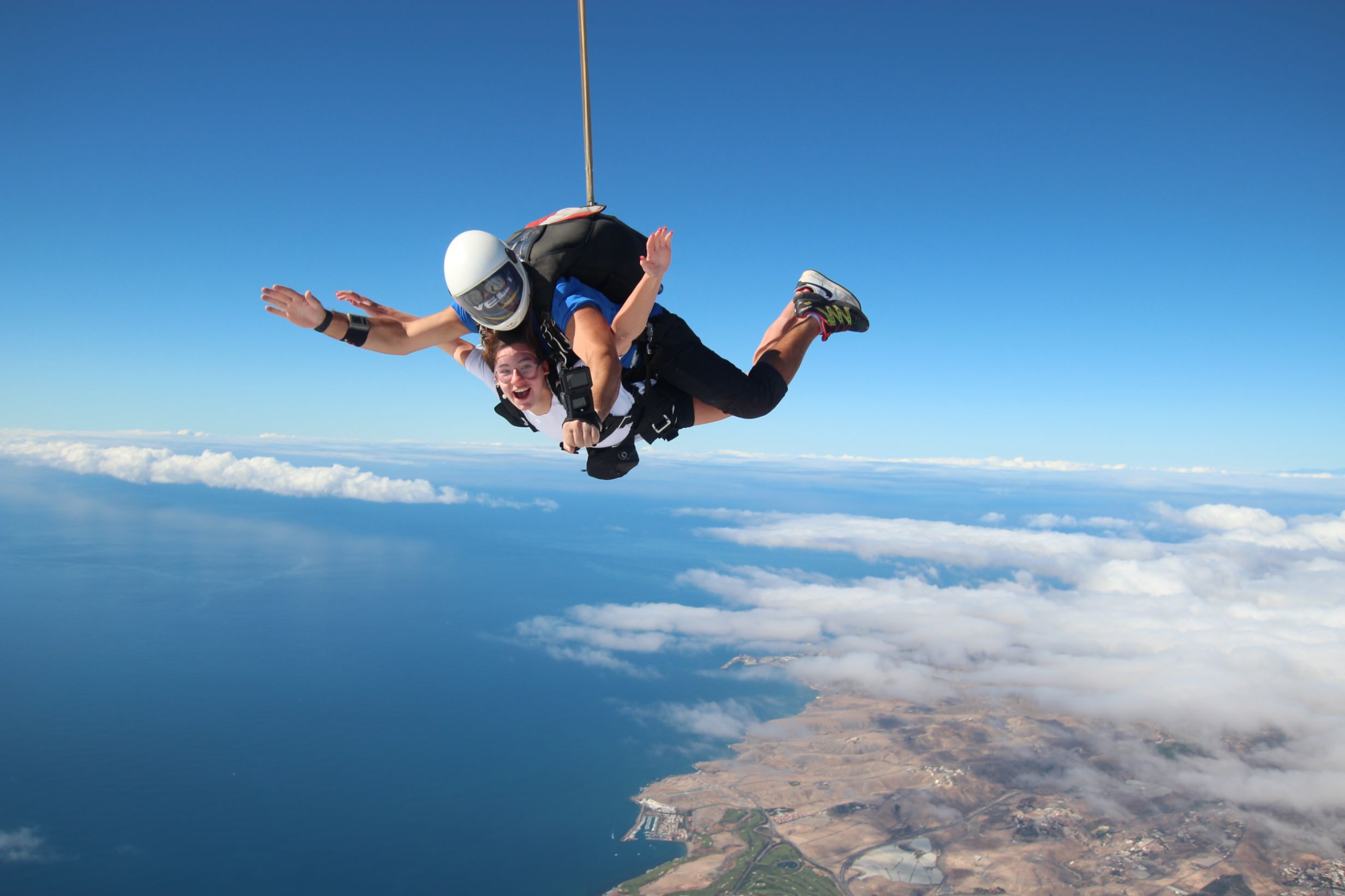
Skydiving  -  feel the rush

Forside 1
Europe's largest saltwater aquarium

Supercar forside 1Supercar GC  - Race and fun

Logo 3
Cardenas holiday homes

Engelsk miniature
The Scandinavian dental clinic

10-215x140
Cadido bus and taxi

Sioux City 1
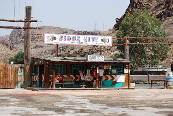
Sioux City - Cowboy country for big and small

Fish on forside 03Sportfishing with "Fish on"

pluscar reservation 215x140
Pluscar, best and cheapest car hire.

Spirit of the sea 215

Spirit of the sea - Dolphin and Whale tour


Fly Gran Canaria 5
Fly Gran Canaria - Puerto Rico

Surtidor Forside
Cold and hot dishes, ready to take with you

Aqualand Maspalomas Forside 1
Waterpark Maspalomas for all ages.

Palmitos Park forside 1Amazing zoo, with dolphins.

This is happening in Gran Canaria

Calendar of local holidays in 2022, for the Canary Islands https://www.eldiario.es/canariasahora/sociedad/calendario-laboral-canarias-2022_1_8643616.html --- Remember you are not allowed to go topless in the cityscape, only on and around the beach - - - The local weather forecast can be found here https://www.eltiempo.es/playa-de-arguineguin.html If you type the city name in the search box, you will get the most local weather we have.. - - - If you need assistance for the disabled while you are in Gran Canaria, please contact Canariainfo. - - - If you need transport to or from the airport, we will get a price from our driver. - - - If you have an accident and need help in hospital or similar places, please contact Canariainfo. - - - Travel insurance for people over 70. www.rejseforsikringsguiden.dk - - - Cocodrilo Park in Aguimes is open Friday - Saturday and Sunday from 10:30 to 16:30 Entrance closes 15.30 - - - https://entrees.es/ Here you will find the schedule of the theatre in Vecindario for the rest of the year. Teatro Victor Jara is located between C.C.Atlanico and the main street, just off the Red Centre. Here you can download the bus schedule for the public buses "GuaguasGLOBAL" - - - Ryanair hires 2000 new pilots for new planes in the next 3 years - - - Football player David Silva takes over a vineyard in Gran Canaria - - - Did you know that there are 61 vineyards in Gran Canaria - - - From Monday the 15th of November and every Monday thereafter there is a market in Puerto de Mogan. it is at the Centro Sociocultural Los Marineros and it is from 09:00 to 14:00.This is what happens in Gran CanariaWelcome to our news
Cookies Information
This website uses cookies to ensure you get the best experience on our website.
All Cookies follows applicable laws, privacy policy.