Canaria info forside billede tekst

Inspiration for experiences on Gran Canaria

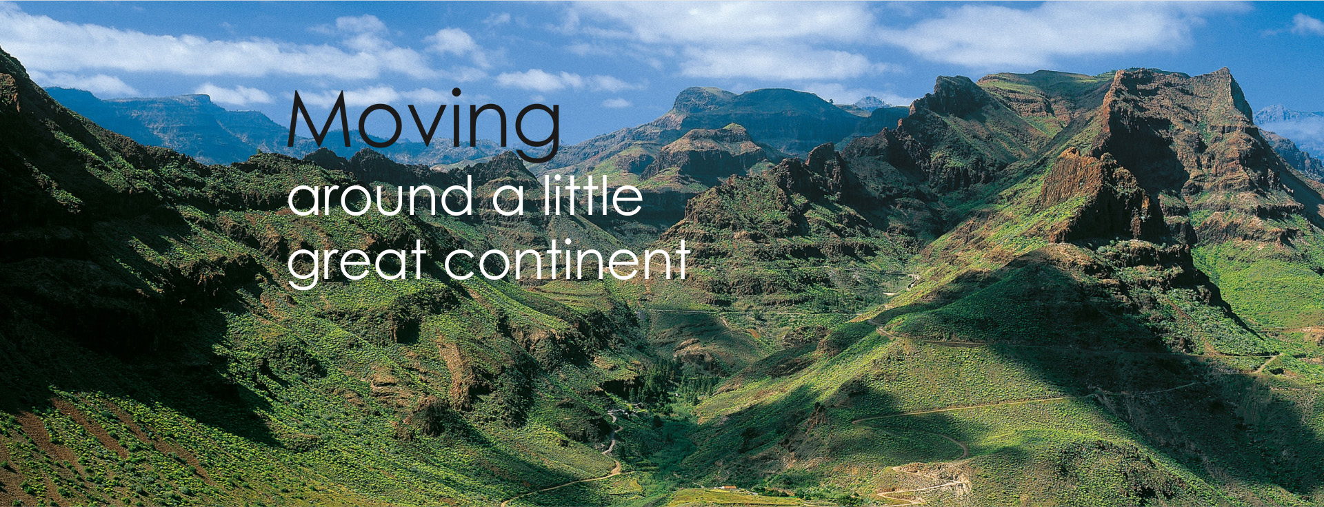
Taste your way to your local favorite rum or get an artistic ’kick’ in the museum galleries. Have a look into the caves where there is still activity or visit Europe's only coffee plantation in mountains on Gran Canaria. Yes - Gran Canaria's mountainous hinterland, away from the turistzone and beach, offers adventures for several day trips. Here at Canariainfo.com you can find plenty of inspiration and we would like to be your guide

Teror Balcones 1050Teror 
The blessed Virgin's capital

On the northern part of the island, home to a peaceful Catholic madonna "La Virgen del Pino" in the church "Basilica de Nuestra Señora del Pino ". Her museum has a large collection of gifts from her admirers, ranging from swords and military orders to toy cars, letters, jewelry, watches and a UN beret.

A beautiful city with fine, antique mansions in the traditional Canarian style with wooden balconies covered by bricks and house corners, doors or windows framed by raw basalt stone from Teror, one of Gran Canaria's most beautiful cities.
Many local events are associated with Teror and is certainly worth a visit.

Transport: Bus 216 from Las Palmas
Arucas Gran Canaria romArucas
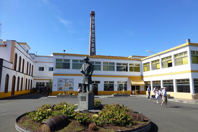
The city with one of the largest rum factory "Fabrica de Ron Arehucas"

In the town of Arucas is the "Fabrica de Ron Arehucas", one of Europe's largest romfactorys, producing a total of 16 different drinks like rom liqueurs flavored wit banana, coffee, chocolate or lemon.

Taste your way to your favorite rom. Yes, all the goodies are free to be tasted before the exhilaration goes shopping area in the factory store.
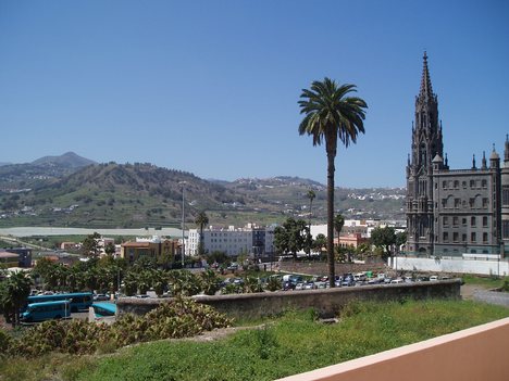
Arucas Gran CanariaAt the other end of town, you can admire the huge, neo-gothic church, "Iglesia de San Juan Bautista" that looks like a fascinating temple from a fantasy tale and has clear similarities with Gaudí-like church, La Sagrada Familia in Barcelona.

Transport: Bus 205 from Las Palmas
munic GaldarGáldar
Gran Canarias little mecca for painting

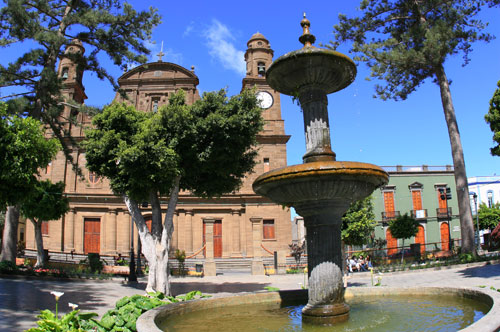
The Canary Islands' most famous cave paintings of red, white and black triangles painted by the island's original inhabitants, together with the remains of a large village built of lava stones admired in Gáldars newly opened archaeological museum, "Parque Arqueológico Cueva Pintada". Gáldar is also worth a visit for its eminent art museum dedicated to the expressionist Antonio Padrón, in color choices and a technique that is reminiscent of Picasso, depicting the Canarian culture and daily life. In addition to one of the island's basic themes is the absence of rain, he describes also scenes of superstition, cockfights, fish hanging to dry on cords, and much more that is the national soul near.
Transport: Bus 105 from Las Palmas
 
monumento natural caldera de bandama gran canariaCaldera de Bandama
From "Grand Canyon" similar backdrop view, to a dizzying look down into the black abyss

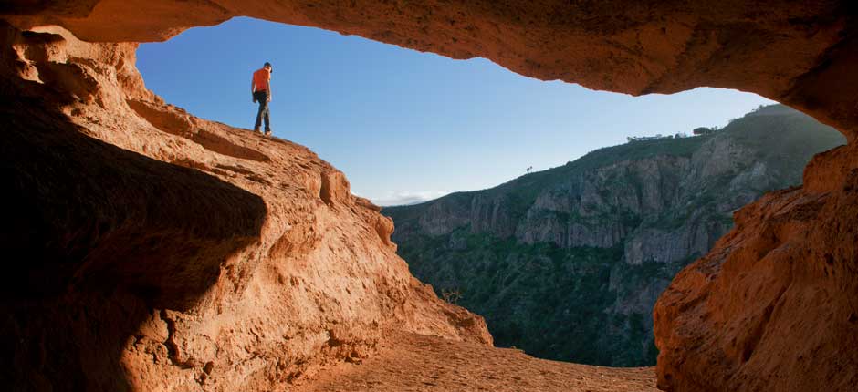
The viewpoint "Pico de Bandama" offers panoramic view of Gran Canaria's east coast, and a look down at 200 meters deep and 1,000 diameter wide, perfectly round volcano crater Caldera de Bandama. Lava stone crunches under your feet, and a forest of cactus sprouting up of the black ground on the way down into the crater, the steep, red slopes creates a Grand Canyon-like backdrop, where every moment expecting to see John Wayne appear on the horse behind a rocky outcrop. In under an hour you can go to the bottom of the crater via the path that starts from the village about 1.5 km below the viewpoint.

Address: about 15 km south of Las Palmas
Transport:Private car to the viewpoint or on a trip with canariainfo
 
kaffe1San Pedro
In San Pedro Valley, Europe's only coffee plantation
 
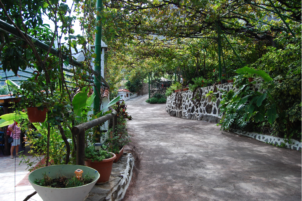
IIn Gran Canarias north western corner is an incredibly beautiful valley "San Pedro" and here you will find Europe's only coffee plantation. It is not only coffee dealing with here, they grow a lot of fruits and then they have their very own wine production.

In this area is also the city Agaete which offers an abundance of experiences. Canaria Info offers regularly guided tour of the coffee plantation and here you get the whole experience, tastings and more. See tour information
 
Transport: Private car or canariainfo tour

Free Advice - Canariainfo

E-mail:
postmaster@canariainfo.com

Skype name:
canariainfo
Canariainfo Skype
Youtube channel:

Canariainfo - Youtube

We can help you with:

  • Quality hotel stays
  • The best restaurants
  • Reliable car renting
  • Guding you about the island’s attractions
  • Arranging fishingtrips
  • Setting up island trips
  • Biketrips and bikerenting
  • Kamelridning
  • And much much more…
See you in Gran Canaria!
  • Hiking Route 9.  Los Marteles Caldera - Tenteniguada via Los Alfaques. Blue Tajinaste Routes

    Hiking Route 9. Los Marteles Caldera - Tenteniguada via Los Alfaques. Blue Tajinaste Routes

    Hiking Route 9. Los Marteles Caldera - Tenteniguada via Los Alfaques. Blue Tajinaste Routes Los Marteles Caldera Altitude: 1529 mDestination:Tenteniguada Altitude: 767 mTotal Distance: 5880 mTime to cover the Route: 2hr. 15’Direction of the route: SW-NENet Difference in Altitude: 762 mDifficulty rating: Low                                           The route runs SW-NE and is classified as a low difficulty itinerary although it can be slippery in the Read More
  • Hiking Route 10. Tecén - Colmenar Bajo via San Miguel ravine

    Hiking Route 10. Tecén - Colmenar Bajo via San Miguel ravine

    Hiking Route 10. Tecén - Colmenar Bajo via San Miguel ravine Starting point: TecénDestination: Colmenar BajoTotal distance: 4930 mTime to cover the route: 2 h.Direction of the route: E-WNet difference in altitude: 253 mDifficulty rating: Low This route goes all along the San Miguel Ravine and connects to two other routes starting at the town of Valsequillo: route nº6 towards Las Read More
  • Hiking Route 6. Valsequillo - Las Vegas

    Hiking Route 6. Valsequillo - Las Vegas

    Hiking Route 6.  Valsequillo - Las Vegas Starting point:Valsequillo Altitude: 550 m Destination:Las Vegas Altitude: 612 mTotal Distance: 1890 mTime to cover the Route: 50minutesDirection of the Route: NE-SWMaximum Difference in Altitude: 141 mDifficulty rating: Low This is a route that formerly connected two traditional agricultural valleys, crossed by the San Miguel and Los Mocanes ravines. The surface is made up Read More
  • Hiking Route 8.  Rincón de Tenteniguada - Roque la Vela - Rincón de Tenteniguada, Route of the Ravines. Blue Tajinaste Routes

    Hiking Route 8. Rincón de Tenteniguada - Roque la Vela - Rincón de Tenteniguada, Route of the Ravines. Blue Tajinaste Routes

    Hiking Route 8. Rincón de Tenteniguada - Roque la Vela - Rincón de Tenteniguada, Route of the Ravines. Blue Tajinaste Routes Starting point:Rincón de Tenteniguada Altitude: 970 mDestination:Rincón de Tenteniguada Altitude: 970 mTotal Distance: 2750 mTime to cover the Route: 1hr. 15’Direction of the route: NE-SW/W-E/S-NMaximum difference in altitude: 205 mDifficulty rating: Low Most of this circular route leads through the protected areas Read More
  • Hiking Route 7. Valsequillo - San Roque via Corona del Montañón

    Hiking Route 7. Valsequillo - San Roque via Corona del Montañón

    Hiking Route 7.  Valsequillo - San Roque via Corona del Montañón Starting point:Valsequillo Altitude: 580 mDestination:San Roque Altitude: 330 mTotal Distance: 9140 mTime to cover the Route: 3h. 30’Direction of the Route: SE-NW/W-EMaximum Difference in Altitude: 621 mDifficulty rating: Low This route is renowned for its ethnographic values related to traditional agricultural and livestock uses. In addition, the first section is Read More
  • Hiking Route 5. Tenteniguada - Valsequillo

    Hiking Route 5. Tenteniguada - Valsequillo

    Hiking Route 5.  Tenteniguada - Valsequillo Starting point:Tenteniguada Altitude: 801 mDestination:Valsequillo Altitude: 538 mTotal Distance: 3060 mTime to cover the Route: 50-60 minutesDirection of the Route: W-ENet Difference in Altitude: 237 mDifficulty rating: Low This route is of huge cultural and ethnographic importance, as it has historically communicated the two main centres in the municipality. A glance at the cobbles on Read More
  • Hiking Route 3. Cuevas Blancas Dam - Rincón de Tenteniguada via La Pasadera ravine. Blue Tajinaste Routes

    Hiking Route 3. Cuevas Blancas Dam - Rincón de Tenteniguada via La Pasadera ravine. Blue Tajinaste Routes

    Hiking Route 3.  Cuevas Blancas Dam - Rincón de Tenteniguada via La Pasadera ravine. Blue Tajinaste Routes Starting point:Cuevas Blancas Dam Altitude: 1665 mDestination:Rincón de Tenteniguada Altitude: 973 mTotal Distance: 3420 mTime to cover the Route: 2hr. 15’Direction of the Route: SW-NENet Difference in Altitude: 692 mDifficulty rating: Medium-low For the most part, this route crosses the Los Marteles Special Nature Read More
  • Hiking Route 1. Los Marteles Caldera - Rincón de Tenteniguada via El Salviar. Blue Tajinaste Routes

    Hiking Route 1. Los Marteles Caldera - Rincón de Tenteniguada via El Salviar. Blue Tajinaste Routes

    Hiking Route 1. Los Marteles Caldera - Rincón de Tenteniguada via El Salviar. Blue Tajinaste Routes Starting point:Los Marteles Caldera Altitude: 1529 mDestination:Rincón de Tenteniguada Altitude: 1043 mTotal Distance: 3470 mTime to cover the Route: 1h. 30’Direction of the Route: SW-NENet Difference in Altitude: 486 mDifficulty rating: Low   The route begins to the north of the Los Marteles Caldera and Read More
  • Hiking Route 4. Cuevas Blancas Dam - Rincón de Tenteniguada via Roque Jincao. Blue Tajinaste Routes

    Hiking Route 4. Cuevas Blancas Dam - Rincón de Tenteniguada via Roque Jincao. Blue Tajinaste Routes

    Hiking Route 4.  Cuevas Blancas Dam - Rincón de Tenteniguada via Roque Jincao. Blue Tajinaste Routes Starting point:Cuevas Blancas Dam Altitude: 1665 mDestination:Rincón de Tenteniguada Altitude: 971 mTotal Distance: 5150 mTime to cover the Route: 2hr. 30’Direction of the Route: SW-NENet Difference in Altitude: 694 mDifficulty rating: Medium The scenic attractions of this route are determined by the fact that it Read More
  • Hiking Route 2. Caldera de Los Marteles – Las Vegas via Los Cernícalos ravine

    Hiking Route 2. Caldera de Los Marteles – Las Vegas via Los Cernícalos ravine

    Hiking Route 2.  Caldera de Los Marteles – Las Vegas via Los Cernícalos ravine Starting pointLos Marteles Caldera Altitude: 1530 mDestination:Las Vegas Altitude: 620 mTotal distance: 9490 mTime to cover the Route: 4h. 30’Direction of the Route: W-ENet Difference in Altitude: 910 mDifficulty rating: Medium-high The route includes one of the most interesting areas of the Los Marteles Special Nature Reserve. Read More
  • 1
  • 2
  • 3
  • 4
  • 5
  • 6
  • 7
  • 8
  • 9
  • 10

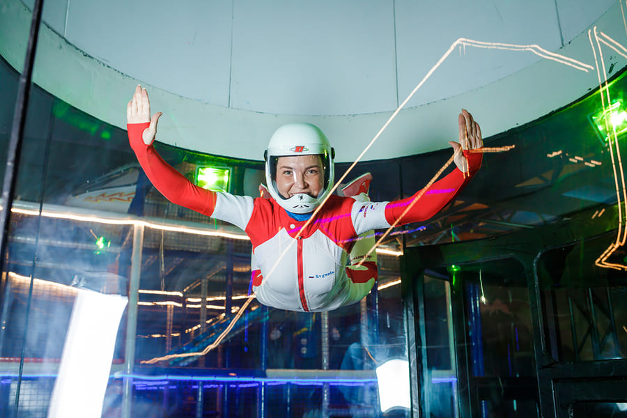
13 Udspring
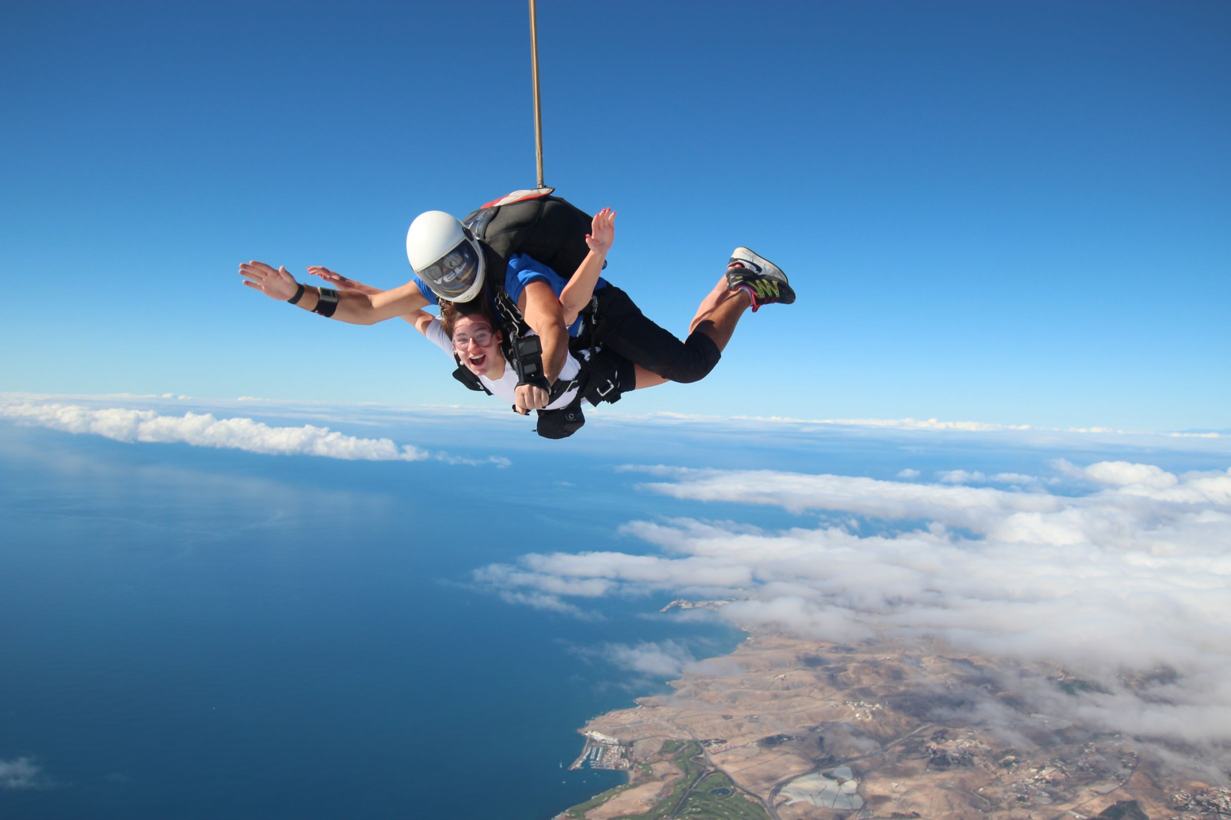
Skydiving  -  feel the rush

Forside 1
Europe's largest saltwater aquarium

Supercar forside 1Supercar GC  - Race and fun

Logo 3
Cardenas holiday homes

Engelsk miniature
The Scandinavian dental clinic

10-215x140
Cadido bus and taxi

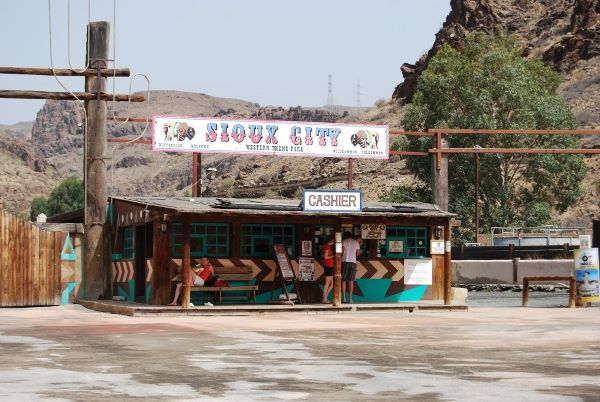
Sioux City 1
Sioux City - Cowboy country for big and small

Fish on forside 03Sportfishing with "Fish on"

pluscar reservation 215x140
Pluscar, best and cheapest car hire.

Spirit of the sea 215

Spirit of the sea - Dolphin and Whale tour


Fly Gran Canaria 5
Fly Gran Canaria - Puerto Rico

Surtidor Forside
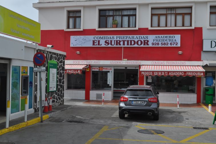
Cold and hot dishes, ready to take with you

Aqualand Maspalomas Forside 1
Waterpark Maspalomas for all ages.

Palmitos Park forside 1Amazing zoo, with dolphins.

This is happening in Gran Canaria

Calendar of local holidays in 2022, for the Canary Islands https://www.eldiario.es/canariasahora/sociedad/calendario-laboral-canarias-2022_1_8643616.html --- Remember you are not allowed to go topless in the cityscape, only on and around the beach - - - The local weather forecast can be found here https://www.eltiempo.es/playa-de-arguineguin.html If you type the city name in the search box, you will get the most local weather we have.. - - - If you need assistance for the disabled while you are in Gran Canaria, please contact Canariainfo. - - - If you need transport to or from the airport, we will get a price from our driver. - - - If you have an accident and need help in hospital or similar places, please contact Canariainfo. - - - Travel insurance for people over 70. www.rejseforsikringsguiden.dk - - - Cocodrilo Park in Aguimes is open Friday - Saturday and Sunday from 10:30 to 16:30 Entrance closes 15.30 - - - https://entrees.es/ Here you will find the schedule of the theatre in Vecindario for the rest of the year. Teatro Victor Jara is located between C.C.Atlanico and the main street, just off the Red Centre. Here you can download the bus schedule for the public buses "GuaguasGLOBAL" - - - Ryanair hires 2000 new pilots for new planes in the next 3 years - - - Football player David Silva takes over a vineyard in Gran Canaria - - - Did you know that there are 61 vineyards in Gran Canaria - - - From Monday the 15th of November and every Monday thereafter there is a market in Puerto de Mogan. it is at the Centro Sociocultural Los Marineros and it is from 09:00 to 14:00.This is what happens in Gran CanariaWelcome to our news
Cookies Information
This website uses cookies to ensure you get the best experience on our website.
All Cookies follows applicable laws, privacy policy.